Landscape infrastructure
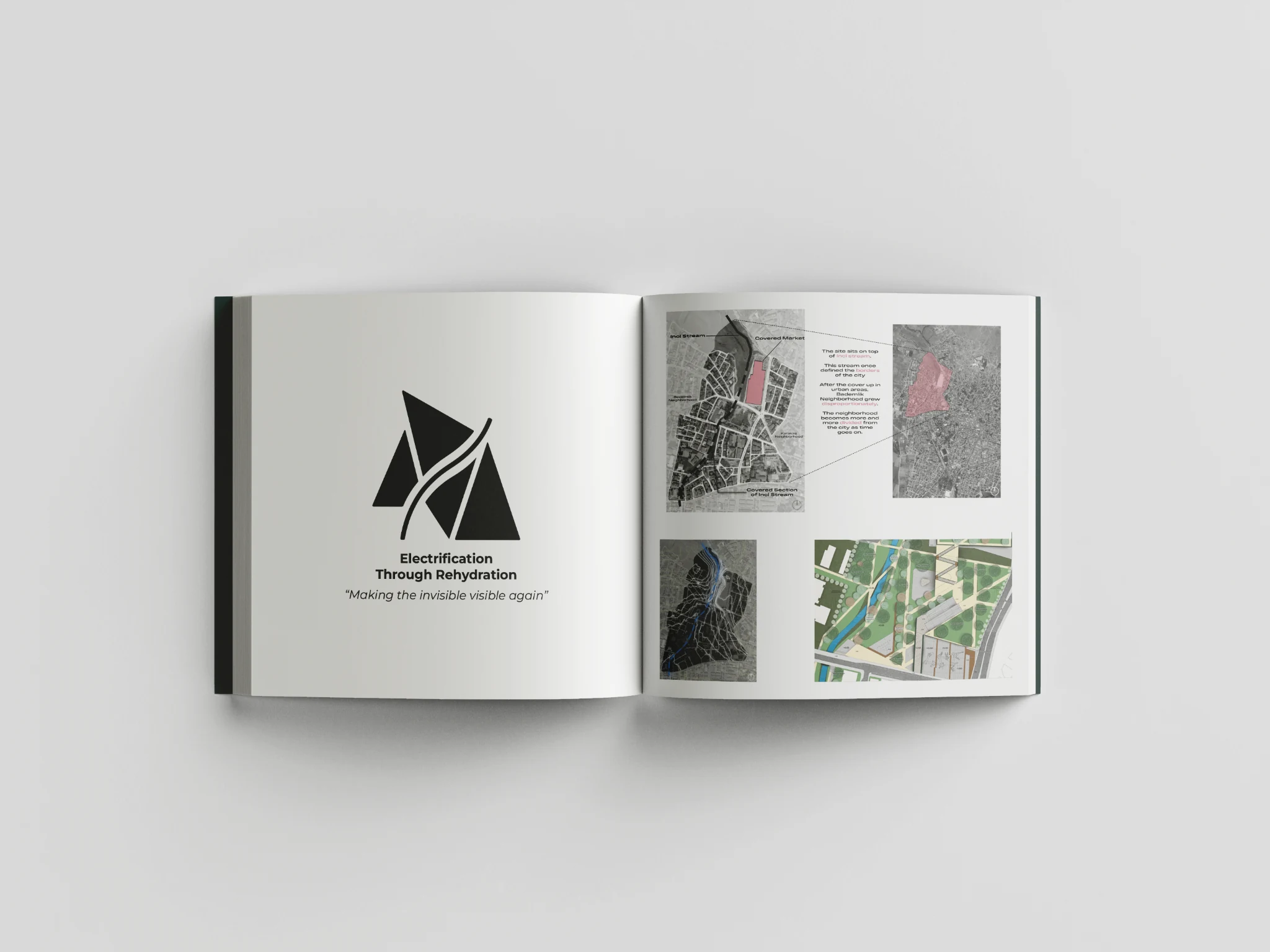
Electrification Through Rehydration
Making an invisible urban water system visible again.
- Project type
- Academic project
- Role
- Site analysis, concept and landscape plan
- Current material
- Portfolio overview spread
Concept
Reveal water through movement and public life.
This project begins with a covered stream and the urban conditions formed around its disappearance. The design uses landscape, circulation and program to reconnect the hidden water system with everyday public space.
The uploaded spread establishes the project through territorial mapping, site identification, the stream corridor and a detailed landscape plan. Future additions can expand the page with sections, planting strategy and sequential experience.
This project page is structured to accept additional plans, sections, diagrams, renders and process images when the original files are ready.